


IN ONE of its most anticipated missions in recent years, the Indian Space Research Organisation (ISRO) will launch NISAR (NASA-ISRO Synthetic Aperture Radar), a sophisticated and expensive earth observation satellite developed in collaboration with NASA, from Sriharikota on Wednesday.
The launch will see India’s GSLV rocket, for the first time, inject a satellite into a Sun Synchronous Polar Orbit, an orbit in which the satellite will scan over the same point on Earth at the same time each day. Usually, PSLV is utilised for such an orbit, but NISAR is a heavier satellite, beyond the capability of a PSLV.
The GSLV launch vehicle has so far been used to put satellites only in a geosynchronous transfer orbit, a highly elliptical orbit that is used as an intermediary to easily take satellites to the high geosynchronous orbits at around 36,000 km where they move with the Earth to remain over the same location every single day.
“This has been a much-anticipated launch,” said ISRO chairperson Dr V Narayanan.
The NISAR satellite is capable of mapping the Earth during the day and the night and in any weather condition. The satellite will scan the entire globe every 12 days, providing a series of very detailed images of the Earth’s surface that can capture changes even as small as a centimetre.
“This is a very advanced satellite that can capture even the slightest of the movements on the Earth’s surface. These observations can help them in mapping changes such as volcanic hazard or landslides and prepare in advance. This is a result of a collaboration that started nearly 10 years ago,” said former ISRO chairperson K Sivan.
The mission marks the first hardware collaboration between the Indian and the US space agencies, with each providing a different radar system for the satellite. NASA’s L-band radar and ISRO’s S band radar are sensitive to two different sizes of features on the Earth as well as two different types of attributes such as moisture content, surface roughness and motion.
Story continues below this ad
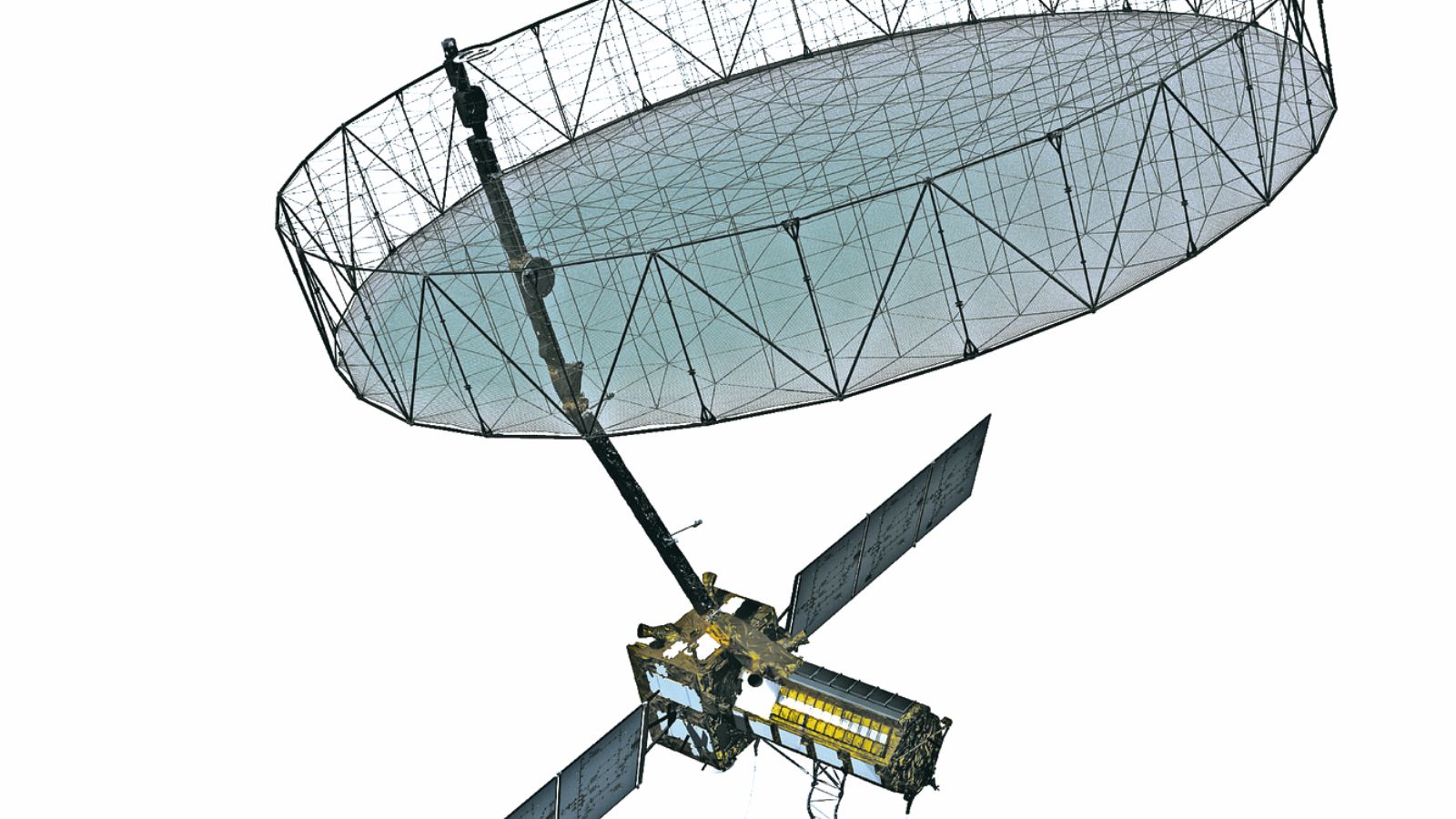 NISAR at Satish Dhawan Space Centre in Sriharikota on July 18. AP
The NISAR satellite is meant to capture detailed information about various systems on Earth such as the changing surface and interior of the planet like magma and volcano eruptions, the cold regions with its ice cover, glaciers, sea ice and permafrost, the terrestrial ecosystems like forest cover, rivers, crop fields as well as the water. It will provide important data to researchers across the globe for better management of natural resources, planning for natural disasters, and importantly, understanding the effects and the pace of climate change.
NISAR cannot predict floods or forest fires but can observe the minutest of changes and provide risk assessment analysis.
The 2,392-kg satellite will be put in a 747-km circular orbit nearly 19 minutes after launch. The mission life of the satellite is five years.
GSLV’s previous launch, earlier this year, had not been entirely successful. While the launch vehicle did place the NVS-02 satellite in the intended orbit, the satellite could not undertake further manoeuvres needed to reach the final orbit. A GSLV launch had also failed in 2021, owing to a pressure drop in the liquid hydrogen tank in the cryogenic stage.
From the launch date, it will take eight to 10 days for the satellite’s full deployment, including the complete blooming of the antenna. Post the launch of any space mission, there is a calibration and testing phase. If the launch is realised on July 30, then NISAR will remain under a 65-day engineering phase during which the preliminary tests and calibration will be performed. On day 65 after the launch, the first, full-frame science data will be taken and the science teams will check for its quality and other parameters. The actual science phase of NISAR will commence on day 70 after the launch. The scientific commissioning phase of NISAR will commence on day 90.
Boost to calamity response
Some of the planned applications of the NISAR satellite include:
• Monitor changes in surface water and soil moisture: This data can provide actionable points to mitigate or better deal with occurrences such as flooding, landslides, crop failures, droughts and wildfires
Story continues below this ad
• Earthquakes: The data from the satellite can be used to map fault zones and fault systems, where an earthquake is likely to occur. Their long-term study can also help in forecasting. Following an earthquake, the data can also be used to locate the areas of damage
• Permafrost: NISAR can observe the changes to the permafrost — the frozen sub-surface layer — that can inform about the communities that may be affected
• Volcanic eruptions: The data from the satellite can be used to characterise and monitor volcanic processes, build models of sub-surface magma movement before, during, and after eruptions. This will facilitate eruption forecasting