

A developing weather system over the Bay of Bengal continues to strengthen and is on track to develop into cyclonic storm Senyar around November 26.
The India Meteorological Department (IMD) and independent forecasters have outlined the impact on the Andaman and Nicobar Islands, other parts of the country, and its likely path. With forecasts still evolving, here’s what we know so far about the trajectory, timing and expected impact of the system.
- 01
When will the cyclone form?
A low-pressure area over the south Andaman Sea has moved towards the southeast Bay of Bengal and will intensify into a depression in the coming week, forecasts IMD. The system will then continue to gain strength as it moves west-northwestwards and will form cyclonic storm ‘Senyar’ on November 26. The cyclone’s probable track or highest likely intensity are yet not available. However, the Met office has warned of heavy to very heavy rainfall (105 – 204mm in 24 hours) to lash the Andaman and Nicobar islands and continue till Tuesday.
- 02
When is the possible landfall window?
The system will travel west-northwest across the Bay through the weekend. Its exact landfall point and timing will become clear only after it reaches cyclonic storm intensity. Weather experts are examining the model guidance, which shows different scenarios beyond November 26. The IMD says the system will continue its movement without a confirmed landfall point yet, and updates will define whether it heads towards the Tamil Nadu–Andhra Pradesh coast or curves northwards.
- 03
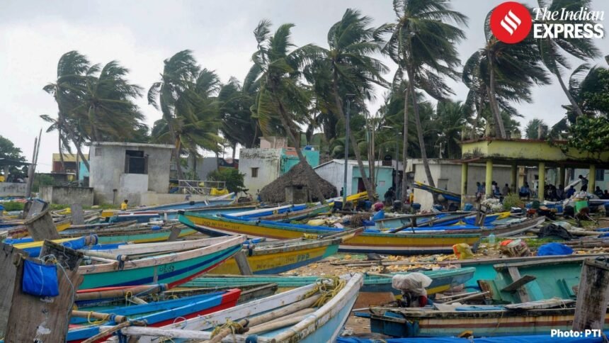
Which area will experience the main impact?
The Andaman and Nicobar Islands is expected to be heavily impacted from November 23 onwards. Rainfall will increase over both island groups through the weekend. The Nicobar Islands will see heavy to very heavy rain (105–204 mm in 24 hours) on November 24 and 25 as the system passes close to the region. Wind speeds will reach 35–45 km/hr, with gusts up to 55 km/hr till Sunday, and rise to about 65 km/hr on November 25.
- 04
What precautions are in place?
Fishermen cannot enter the Andaman Sea and southwest Bay of Bengal till November 25 because of strong winds and rough seas. The IMD has extended the restriction over the southeast Bay of Bengal till November 28. Local authorities in the islands are monitoring rainfall trends closely as the system intensifies. Residents in coastal and low-lying areas have been advised to track daily bulletins for wind and sea updates.
- 05
Why is the Cyclone named ‘Senyar’ ?
The name “Senyar,” meaning “lion,” was submitted by the United Arab Emirates and is part of the pre-approved list of tropical cyclone names used in the region. These lists are compiled under a naming system developed by member countries of the World Meteorological Organisation (WMO) and the UN Economic and Social Commission for Asia and the Pacific (ESCAP) Panel on Tropical Cyclones. According to the current roster, “Senyar” is the designated name for the next cyclonic system that forms in the North Indian Ocean.